Tropical Storm Erin Could Become Atlantic’s First Hurricane of 2025

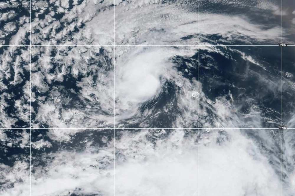
MIAMI — The 2025 Atlantic hurricane season is officially heating up. Tropical Storm Erin formed in the eastern tropical Atlantic Ocean on Monday and is being closely monitored by forecasters who say it could strengthen into the season’s first hurricane later this week.
Latest Advisory on Tropical Storm Erin
According to the Miami-based National Hurricane Center (NHC), Tropical Storm Erin was located about 430 miles west-northwest of the Cabo Verde Islands as of Monday afternoon. The storm currently has maximum sustained winds of 45 mph and is moving westward at a brisk 20 mph.
Forecasters are predicting a period of gradual strengthening over the next several days. The storm is on a general westward path and could reach hurricane intensity by the latter half of the week. While this potential development is significant, the NHC stresses that it is still too early to determine any possible impacts from Erin as it moves closer to the northern Leeward Islands. There are currently no coastal watches or warnings in effect.
Other Active Storms in the Atlantic and Pacific
While Erin holds the attention in the Atlantic, two other systems are active in the Pacific. Hurricane Henriette has strengthened into a Category 1 storm, located well away from Hawaii. The storm has maximum sustained winds of 85 mph but poses no immediate threat to land.
Additionally, the remnants of former Tropical Storm Ivo have dissipated in the Pacific, about 615 miles west of the southern tip of Mexico’s Baja California peninsula. Forecasters have confirmed that the remains of Ivo are not a threat to land.
What’s Next for Tropical Storm Erin
The formation and potential intensification of Tropical Storm Erin are a reminder that the Atlantic hurricane season is entering its most active period. Residents in coastal areas of the Leeward Islands and surrounding regions should continue to monitor official advisories from the National Hurricane Center over the coming days. The storm’s path and intensity will become clearer as it continues its journey across the Atlantic.


